| Great Smoky Mountain National Park is located on
the border between Tennessee and North Caroline. It
includes 520,000 acres of mountainous terrain that includes
several of the tallest tree site in the eastern United
States. For the purpose of this locations listing it is
treated as a separate entity. Will Blozan, Jess Riddle,
Michael Davie and a few others have participated in most trips
in the park. The trip reports are organized by drainage
basin or district based upon guidelines
sent to me by Jess Riddle. Any errors in placing the trip
into the correct basin are entirely my own. .pdf format maps of
the park are available at: http://www.nps.gov/grsm/pphtml/maps.html
GSMNP quads maps are available at http://www.dlia.org/atbi/science/park_quad_maps.shtml
- Ed Frank

NPS
photo - Great Smoky Mountains National Park
Abram's Creek/West End
Big Creek
- Baxter Creek June
2002, Jan,
April, Aug, Nov 2003, Jan, April 2004
- Baxter
Creek, East Fork Dec 2004
- Baxter Creek Trail
Oct 2004
- Bettis Branch, Big Creek
Jan 2004
- Big Creek July 2003, Dec
2003, Jan 2004
- Big Creek/Baxter
Creek Galleries
 Dec 2004
- Big Creek-
Topography and Tree Height May 2005
- Caching Up - Big Creek
June 2007
- Chestnut Branch Trail,
Big Creek Feb 2004
- Leatherwood Branch,
Big Creek March 2004
- Lower Big Creek
Update Nov 2004
- Lower Mouse Creek
March 2005
- Mouse Creek/Big Creek May
2003
- Sterling Ridge
(Cataloochee and Big Creek) Oct
2002
- Unnamed
Coves, Big Creek April 2003
- Upper
Chestnut Branch and Kilby Branch Nov 2004
- Big Creek Soils
Jan 2004
- !!!Smokies Rule!!! Oct 2002
Cataloochee Creek
- Bennett Branch
Pine Feb 2005
- Big Fork Ridge
hemlocks
 Jan
2007 Jan
2007
- Big Fork Ridge -
Holy Grail Hemlocks Feb 2007
- Big Fork Ridge -
172.1 foot "Survivor" hemlock - Holy Grail Found!
 Feb 2007 Feb 2007
- Boogerman Pine Gallery

- Boogerman Pine
Gallery 2
 March 2005 March 2005
- Boogerman
Pine March 2002
- Caldwell
Colossus Climb
 March 07, 2006
- Cataloochee Creek June
2002, July 2003, Sept 2003
- Cataloochee
Death Photos
 Oct 2007
- Cataloochee - Francis, Ivan,
Jeanne, and Mountain Mama
 Sept 2004
- Cataloochee Valley Super
Shrubs June 2005
- Cataloochee's
Finest: Usis and others Oct 2007
- Den Branch - Ash
Master
 Feb 2007
- Dude Branch Nov 2003
- Hurricane Creek July
2003
- Hurricane Creek
Dec 2006
- Jim Branch
 July 2002,
March 2003. Aug 2005
- Jim
Branch Hemlock Climbs and Adelgid Survey
 June 2005
- Leaning Tower Hemlock
climb
 Oct
2007 Oct
2007
- McKee
Branch Feb 2005
- Middleton
Oak/Sag Branch Tulip Climb
 Feb 2004
- Pretty Hollow Creek
Oct 2003
- Sag
Branch and Boogerman Pine, GSMNP Jan 2007
- Sag Branch
Poplar w/gallery James Smith
 April 2006
- Sag
Branch Tulip Climb & Gallery
 Feb 2004
- Sag Branch,
Cataloochee April 2004
- Upper Den Branch May
2002
- Usis Hemlock Climb
 Feb 2007 Feb 2007
- Usis Update
(dead)
 Oct 2007
- Catching Up - Usis Hemlock
Treatment June 2007
- West Prong of
Sag Branch Sept 2002
- Winding Stairs
Branch, Eastern Fork Feb 2003
- Winding Stairs Loner
w/gallery June 2006
- !!!Smokies Rule!!! Oct 2002
Cosby
Deep Creek
Greenbriar District
- Greenbriar District
Description Jan 2007
- Laurel
Branch leviathan Climb Dec 2006
- Bald Top Ridge Nov
2005
- Cannon Creek and Lowes Creek
Feb 2006
- Dunn
Creek (gallery & report)
 May 2005
- False Gap Prong
Feb 2007
- Greenbrier and Cosby Area
(TN) Nov 2004
- Greeenbriar Poplar
Dec 2006
- Kalanu Prong March
2006
- Tsuga Search
Report: Wooly Mammoth Hemlock, Kalanu
Prong, TN, GSMNP
 May 17, 2006 May 17, 2006
- Long
Branch Hemlock, Metcalf Bottoms Picnic Area, Thunderhead
Prong, Twin Creeks, Roaring Forks Motor Nature Trail, Boulevard
Prong
 July 2005 July 2005
- Lowes and Cannon Creeks Feb
2006
- Porter's Creek May 2002
- Porter's Bowl Oct
2003
- Porter's Creek Feb
2006
- Ramsey Prong and Lester
Prong July 2006
- Ramsey Prong, TN
 April 2005
- Webb Creek Oct 2005
Kanati Fork
Oconaluftee River
Raven Fork
West Prong Little Pigeon River
Miscellaneous Locations
 Enloe-opal: This is a picture of a hemlock growing over Raven Fork in
GSMNP, the lone tree left in a huge blowdown from Hurricane Opal. Notice it lost one half of a codominant crown.
General Discussions
Tsuga Search
Project 

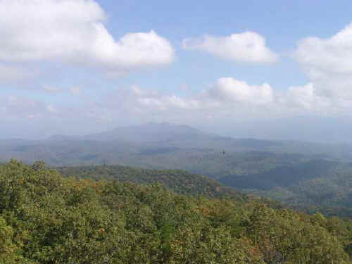
View from Webcam on Look Rock, GSMNP Oct 18, 2006
|