 |
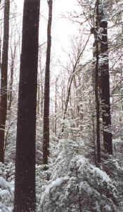
View from the hillside above Wolf Creek
near the narrows. Largest trees in the photo are tulip
poplars. |
 |
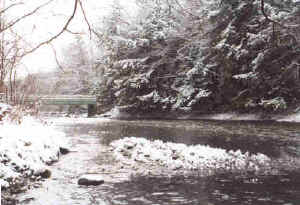
Wolf Creek from the bridge just below the
narrows. Mature hardwood forest is on the right, cliff
extends along the left shore. A trail takes a circular
route over the flood plain and up onto the hillside to
the right. |
 |
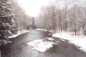
Wolf Creek looking downstream toward the
bridge. Parking area is on the right side of the bridge
about 50 yards from the creek on the left side of the
road. Trail begins just past the left end of the bridge. |
Wolf Creek Narrows is located in northwestern Butler County,
Pennsylvania. It consists of 115 acres owned by the Western
Pennsylvania Conservancy with a trout stream flowing along the
southern border. Wolf Creek flows through a narrow valley which
is supposed to have been a cave that was eroded by melting
glaciers and now has 50 foot cliffs on either side of the creek.
The land was granted to a Revolutionary War veteran and remained
in his family until purchased by WPC in the late 70's/early
80's. The majority of the site was never logged, and what
logging did occur took place on the tops of the ridges around
the year 1900. There is a narrow flood plain near the western
end of the property which has large sycamore, tulip, hemlock and
red maple. The drier ridge tops have sugar maple, beech, black
cherry and red oak. A 1.5 mile trail loop begins at the bridge
over Wolf Creek and gives access to most of the site, but bring
boots because it gets pretty swampy. I've visited the site twice
but only had a short time to measure trees. The following is a
quick list of the tallest...
CBH HEIGHT
Tulip n/a 124
Tulip 4.2 103.5
Tulip 6.8 109.4
Red Maple 8.4 105.7
Sycamore 8.9 118.3
Sycamore 7.4 117.3
N Red Oak 7.4 108
Beech 7.0 109.3
This site is well known for its spring wildflowers including
large areas of trillium (Trillium grandiflorum), bluebells (Mertensia
virginica), spring beauty (Claytonia virginica) and trout lily (Erythronium
americanum). As I measured the trees this past April I had to
pay constant attention to my footsteps to avoid destroying them.
This site needs a more thorough going-over this fall and
hopefully I'll be able to post a more complete tree list at that
time.
Directions - from the Slippery Rock exit of I-79 take Rt. 108
to Slippery Rock. Turn left at the first traffic signal, then
take the next left (Water Street) and go about 2 miles to the
iron grate bridge over Wolf Creek. Parking is just across the
bridge on the left side of the road, and the trail loop is on
the opposite side of the bridge on the west side of the road.
Carl Harting
|