|
==============================================================================
TOPIC: Parker Dam State Park
http://groups.google.com/group/entstrees/browse_thread/thread/94752cfff00cde37?hl=en
==============================================================================
== 1 of 1 ==
Date: Thurs, Oct 11 2007 4:49 pm
From: "Edward Frank"
ENTS,
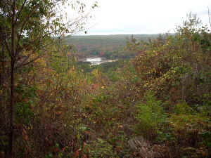
Parker Dam from atop the hill |

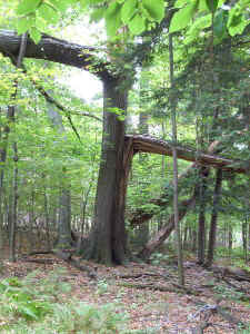
Logs blown down by the windstorm. |
Today I made a short trip to parker dam State Park in Clearfield
County in west central PA. The 968 acre park now features an
artificial lake in a landscape forested by second growth forest.
Full-scale lumbering in the area probably began around 1870. A
history of the park is presented on the park's website:
"The park takes its name from William Parker, who leased
lumbering rights from John Otto. Parker built a splash dam on Laurel
Run at the site of the present lake. The forests were cut and recut,
first for the white pine and later for hemlock and hardwoods. In the
early 1900s, the log boom at Williamsport became inefficient when
geared locomotives moved the logs directly from the forests to the
mills. By 1911, the log boom was dismantled and the Central
Pennsylvania Lumber Company built logging railroads and logged the
land a final time. Crews loaded up to 45 railroad cars a day until
logging ended in 1912. Look for old railroad grades still visible on
Moose Grade Road and Beaver Dam and Quehanna hiking trails. For
nearly two decades after the last tree was felled, fires and floods
wreaked havoc. In 1930, the state of Pennsylvania began buying land
from the Central Pennsylvania Lumber Company for $3 an acre. Around
the same time, President Franklin Delano Roosevelt started a great
conservation movement to help stem the Great Depression and restore
the nation's natural resources. He called it the Civilian
Conservation Corps (CCC). In 1933, the CCC boys set up camp at the
intersection of Tyler and Mud Run roads (Camp S-73). The CCC planted
trees, built roads and trails and constructed the current dam of
native sandstone on the site of William Parker's splash dam. Their
handiwork is seen in the stone pavilions and in the CCC Interpretive
Center near the breast of the dam. Parker Dam was designated a
recreational reserve in 1936. The CCC, and later the Works Progress
Administration continued improvements, until many CCCers were
drafted in 1941 for World War II."
 |
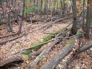
Wind Damage |
The park reportedly had some large trees a couple decades ago.
However in 1985 the park's was struck by a tornado knocking down the
largest of these trees. A trail called "Trail of the New
Giants" passes through the area hit by the hurricane:
Trail of New Giants: 1 mile, moderate hiking, no blazes
On May 31, 1985, one of Pennsylvania's largest and strongest
tornadoes roared through the park and destroyed the towering forest
of ash, oak, beech and sugar maple trees. The Trail of New Giants
cuts through the blowdown and the 250-acre Windstorm Preserve. Walk
the trail and see the forest regenerating. A spur trail leads to a
beautiful vista of the park and surrounding forest.
Part of the area affected by the tornado has been designated a
Windstorm Preserve:
Windstorm Preserve: The tornado of 1985 blew a swath of destruction
across Parker Dam State Park. The forest to the west of Mud Run Road
has been left in a natural state. Note the large, bare tree trunks
still standing in testimony to the power of the storm. The Trail of
New Giants runs through this area. On the east side of Mud Run Road
fallen trees have been salvaged and removed. Explore the two areas
to see if the forest regrows differently in the two areas.
I decided to check out the area in the waning hours of the
afternoon. I had hoped there would be some large trees that might
have survived the tornado scattered about, but the entire area was
leveled essentially flat. There were a few smaller surviving oaks in
the windstorm area, but nothing of any size. As a forest the area is
actually very interesting if you are not looking for big trees.
Regrowth has gone wild among the downed and shattered remnants of
the former forest. The trail winds and wends its way through a
jungle of beech, sugar maple, and striped maple. Some areas seem
held together by masses of grape vines, large downed trunks all
neatly lined in the same direction cover large areas of the forest
floor. There are occasional other species present; a black cherry
here, a red maple there, and an occasional hickory.
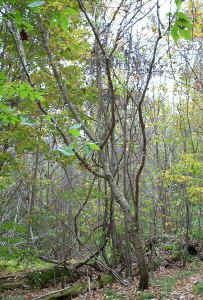
Devil's Walkingstick |
There were a
couple of sumacs, but nothing of any size. I did however find a
devil's walkingstick with a cbh of 2 feet, and a height of around 15
feet along the trail. It was worthwhile to visit to see how the
forest was regenerating among the corpses of the fallen trees.
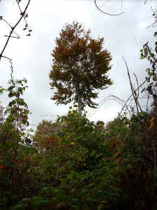
Sugar Maple atop the hill |
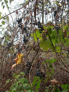
Grapes and grapevines |
About
half-way along the trail is a side path leading the hilltop and an
overview of the dam and lake. The lake was drained currently to
undergo some repairs of the breastwork of the dam. I had hoped to
get an overview of the tornado path, but the overlook faced in
another direction. At the very top was a lone sugar maple standing
upright among an understory of smaller trees and grape vines, bright
with dark red leaves. On another sugar maple passed on the way down
a severely tilted sugar maple had two stem growing upward like new
stems on the nearly fallen trunk. It is a nice trip and I encourage
people visiting the park to check it out.
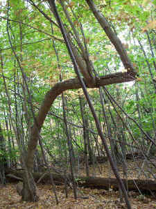
Sugar Maple |
One other thing I need to explore at the park on a future trip is a
Geo Tour. A pamphlet available a the park office lists the GPS
coordinates of the largest tree of each of thirteen species of tree
found in the park. I am curious how their measurements would compare
to mine - They don't give their measurements, just AF points, but
some of them are good sized trees.
Ed Frank
|