Ohiopyle
State Park, Ferncliff Peninsula, PA
On
Tuesday Nov. 14, 2006 Anthony Kelley and myself visited Ohiopyle
State Park in southwestern Pennsylvania.
The park includes 19, 052 acres of land in Fayette County
in the Laurel Mountains. More
than 14 miles of the Youghiogheny [yaw-ki-GAY-nee] River Gorge
that passes through the heart of the park.
The 1,700 feet
deep Youghiogheny Gorge was formed by the Youghiogheny River
cutting through Laurel Ridge.
The Youghiogheny flows northward from Maryland and
West Virginia to Pittsburgh, where it joins the Allegheny River to
form the Ohio River. Through
this section of the park the river drops 60 feet in a distance of
2 miles. The major
waterfall on the Youghiogheny River drops 40 feet as this major
river cascades over a sandstone cliff.
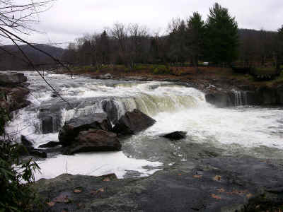
Falls of the Youghiogheny
Farther downstream are several series of whitewater rapids.
The famous Lower Yough begins
after the Ohiopyle Falls and flows seven miles downstream to the
Bruner Run Take-out. This is the busiest section of whitewater
east of the Mississippi River.
There are numerous
sections of Class III
and IV rapids and some sections of I and II suitable for
beginners.
The
park itself receives about 2, 000,000 visitors per year, primarily
to see the spectacular Falls of the Youghiogheny and other
waterfalls in the park and to participate in the whitewater
rafting experience. Cucumber
Falls is another spectacular
40 foot water fall immediately off the roadway within the park.
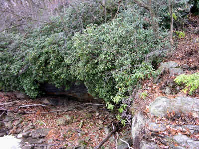
Rhododendron thicket near the falls
Our
destination was the Ferncliff Peninsula immediately across the
Falls of the Youghiogheny from the observation/viewing area.
This 104 acre peninsula was declared a National Natural
Landmark. In 1992, Ferncliff Peninsula was also declared a State
Park Natural Area. Marcia
Bonta, writer and naturalist, writes that Bruce Kershner rated
Ohiopyle State Park's Ferncliff Natural Area Ferncliff Peninsula a
Class B+ old-growth
area including a 20 acres of old-growth along the falls and rapids
of the Youghiogheny River.
The peninsula is formed where the river makes a horseshoe
bend around a harder outcrop of sandstone.
The bottom of the gorge is deeper and a somewhat
warmer than the surrounding territory.
Water flowing northward brings seeds from species that
normally are found only in areas farther south to the peninsula.
The
following is an excerpt from Trees & Shrubs of Ferncliff Park,
a 1962 Pocket Guide by Dr. Otto E. Jennings.
“Ferncliff Park was saved for the enjoyment of the
present and future generations in 1951 when the late Edgar J.
Kaufmann purchased it as it was about to be lumbered. He presented
the tract to Western Pennsylvania Conservancy.
Ferncliff Park, the "Peninsula," is formed by the
Youghiogheny River as it makes a horseshoe curve at Ohiopyle,
Fayette County, in south-western Pennsylvania. Its 100 acres have
become the nucleus of a program destined to include several
thousand acres of surrounding scenic splendor as one of the most
beautiful spots in the state.
It is a botanically important natural area which for more
than 75 years has been known as the habitat of many rare and
unusually interesting plants, a considerable number of which are
here at the northern-most limit of their range.
In the general Ohiopyle area there have now been discovered
127 different kinds of trees and shrubs. Notwithstanding its
relatively small area and rather limited variety of ecological
environments, Ferncliff Park contains at least 87 species and
varieties of woody plants. It is quite probably that all the kinds
of trees that were present when the first botanical studies were
made - before the area was cut over in 1911 - are still present,
although in different proportions. It is now beginning to assume a
primeval appearance. The most common trees in the Park are the
oaks - the black, red, scarlet, white, and chestnut oak. Among the
various other trees that are sure to attract attention are
shellbark hickory, the tulip tree with its straight column-like
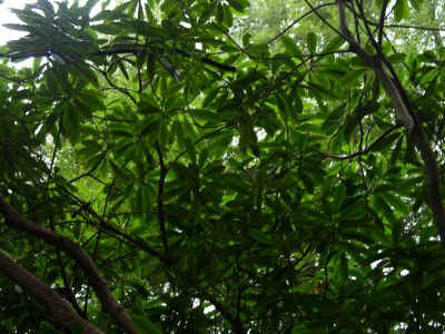
boles and artistically lobed leaves, the cucumber tree with large
tropical-like leaves, and the beech with its pale, smooth bark.
Along the Magnolia Trail the three or four examples of the
Umbrella Tree here reach their northernmost know limit, but they
are among the large rocks near the river's edge and are so
difficult of access that their preservation is fairly well
assured. The
Youghiogheny River at Ohiopyle falls 90 feet in less than two
miles. The major waterfall is about 40 feet. As the river sweeps
around the bend during floods it scours the outer bank down to
bedrock, thus exposing a rather flat area of rock strata slightly
tilted upstream with numerous breaks and crevices which afford a
habitat for various mosses and crevice plants, a number of which
are rare or noteworthy for our region. Preserved as a protected
area it continues to serve as a laboratory for the person
interested in observing growing plants and trees reacting to
nature's influences without human interference. At the same time,
it provides healthful and aesthetic recreation for the visitor who
respects its significance.”
The
Western Pennsylvania Conservancy was the primary architect in the
creation of the park. In
addition to the donation of the area including Ferncliff Peninsula
help came from two more milestone land transactions. West Penn
Power Company donated rights to land across the river from
Ferncliff, and Mrs. Albert Keister donated a tract of land
opposite Ferncliff, which contained the 40-foot Cucumber Falls. On
May 2, 1963, WPC transferred 2,800 acres to the Commonwealth to
form the nucleus of the new state park. By 1965, WPC conveyed
nearly 10,000 of the 18,000 acres slated for the park’s initial
landscape.
I
arrived somewhat late, with Anthony waiting in the parking lot by
the observation tower. Traffic/road
construction/wrong turns… We
hiked across the bridge and into the natural area.
There are a number of trails on the peninsula.
The “Ancient Forests of the Northeast” book recommended
always taking the outer turns at every intersection, so that was
out plan. The
outermost trail is called the Ferncliff Trail, and includes a few
side spurs to various overlooks.
Going clockwise the trail follows the shoreline of the
river to just past the Falls of the Youghiogheny before climbing up
the slope to the ridgetop. The
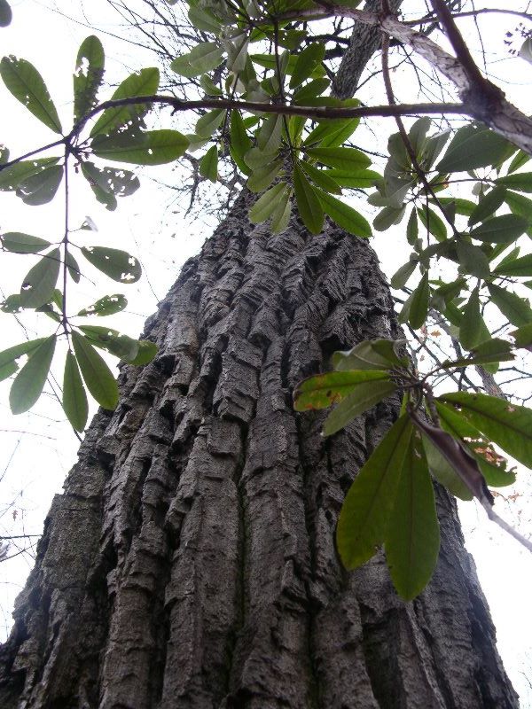
rocks along the river and in the core of the peninsula itself are
Pennsylvanian age Pottsville Sandstone.
Various plant fossils including giant horsetails, seed
ferns and the like are preserved in the bedrock.
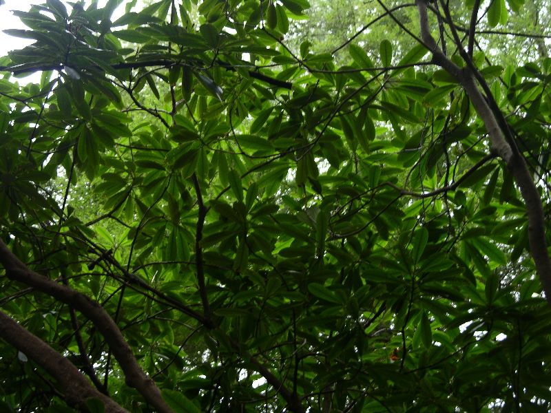
On the steep sides of the peninsula are massive thickets of
Great Rhododendron. Looking
from across the river as we were leaving we likely missed the
tallest hemlock on the peninsula as we walked by in while
traversing this section of the trail.
Close up the Falls are very impressive.
You can feel the power of the water as it thunders down the
waterfall. Just past
the falls the trail climbs up the cliffside.
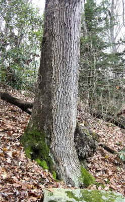
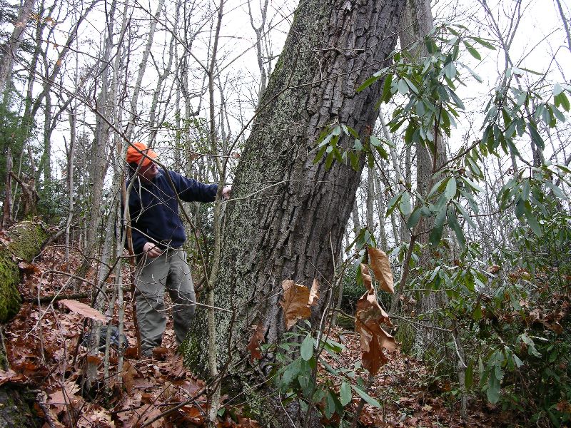
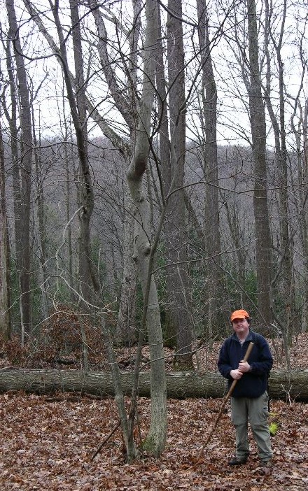
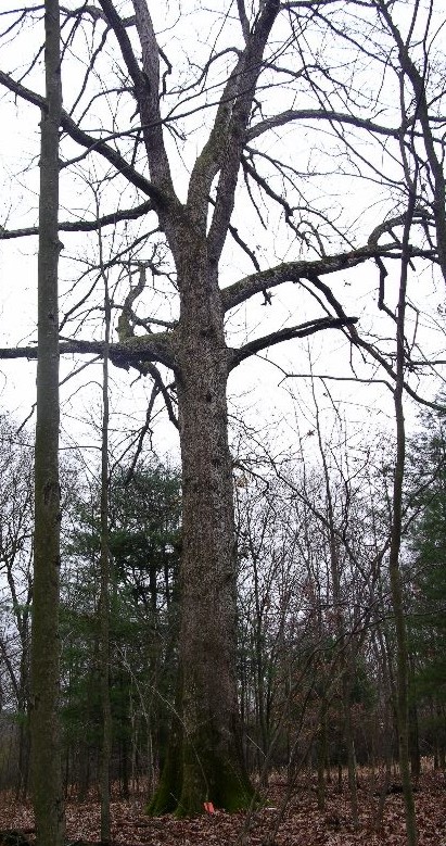
Black oak - cbh 10', height 90' tall |

Chestnut Oak - cbh 8' 07", height 105.5 tall |
Along
this section we stopped to measure our first tree.
It was a large Black Oak with a burl at its base growing on
the upslope side of the trail.
cbh 10’ 0”, height 90 feet. (I think Anthony got a
better measurement from atop the hill later in the trip).
The next tree was a Chestnut Oak, cbh 8’ 07”, height
105.5 feet. Another
Chestnut Oak was next on the river side of the trail.
The trunk curved outward and up from the side of the trail.
cbh 10’ 02”, height only 56.5 feet.
It was an old looking beat-up gnarled tree.
Impressive looking even if it not that tall.

Chestnut Oak (same tree as above) - cbh 8'
07", height 105.5 tall |

Chestnut Oak on cliff side - cbh 10' 2", height
56.5 tall |
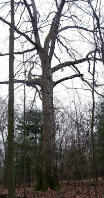
We
continued around the trail measuring trees.
There were wide variety of oak species present:
White Oak, Chestnut Oak, Red Oak, Black Oak, and Scarlet
Oak. There was some
discussion over the identification of some of the species, but we
eventually settled on what we believe are the correct
identifications. There
are a number of trees of significant height along a lower level
terrace above the river. These
include some taller white pines, hemlocks, tulip trees, and
sycamores. The
limited time and the vertical cliff below the trail thwarted or
exploration of this area, but we will return to get more numbers.
In addition, I measured a number of smaller species just to
add to the species total for the area.
We collected enough for a Rucker index, but do not believe
we have the tallest of any of the species present.
We did not locate any of the Umbrella magnolia on this
trip. Maybe when the
leaves are out we can distinguish them.
Species
cbh
height
Black
Oak
10’ 00”
90
1
Chestnut
Oak
8’ 07”
105.5
2
Chestnut
Oak
10’02”
56.5
Hemlock
5’ 11”
90.5
3
White
Pine
6’ 10”
125
4
Red
Oak
8’ 00”
90
5
Tuliptree
6’ 04”
108.6
Scarlet
Oak
7’ 11”
108.5
6
Cucumber
2’ 10”
65.2
10 (darn)
White
Oak
5’ 11”
112.2
7
Scarlet
Oak
8’ 05”
103.1
American
Beech
5’ 04”
89.5
8
White
Oak
5’ 08”
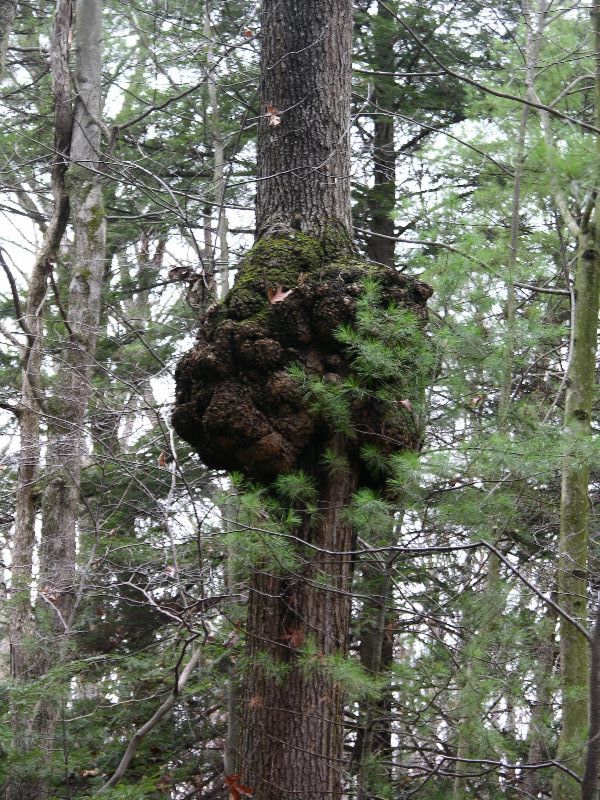
Giant burl 20 feet up the tree
Tuliptree
6’ 09”
117.5
9
White
Pine 9’
08”
109.8
Striped
Maple
1’ 09”
40.5
White
Oak
11' 2.5"
95.5

Large burl in white oak tree |
Rhododendron canopy in small alcove |
The
Rucker Index is not really representative of the trees on the
site. I am sure there
are many taller specimens than what we measured, plus other
species we did not measure on this scouting trip.
Even including the short cucumber I measured (because it
was there) the Rucker Height Index is still 99.4, and if Anthony
got a better height on the Black oak, we will be over 100.
Rucker
Index: 99.4

Striped Maple - cbh 1' 09", height 40.5' |
White Oak - cbh 11' 2.5", height 95.5 |
We
measured as we circled around the peninsula.
Once the circle was completed we headed out the Oakwood
trail to reach the first black oak we measured.
Anthony took some additional shots and got a better height
on the tree (- I don’t have it).
I had climbed back down to the Ferncliff trail to confirm
we were shooting the right tree.
We headed back from there.
When we reached the parking lot across the river we spotted
a black oak with a really fat, unusually shaped trunk.
We had to stop and measure it:

Parking
lot Black Oak
Cbh
16’ 11”
Height
69.3’
From
here we headed to Cucumber Falls to see if there were any older
trees in the steep gorge. The
waterfall was spectacular - unfortunately my photos did not turn
out. It tumbles from
a flat streambed down a 40 foot drop in a fall 15 feet wide.
Below is a scenic rocky alcove formed by undercut cliffs.
It is only a short distance down the stream to the Youghiogheny. With the
light fading we headed for home.
Ed
Frank