|
==============================================================================
TOPIC: Fw: Trip report draft
http://groups.google.com/group/entstrees/browse_thread/thread/32f3ae007484d64b?hl=en
==============================================================================
== 1 of 3 ==
Date: Thurs, Oct 16 2008 4:53 pm
From: "Edward Frank"
ENTS
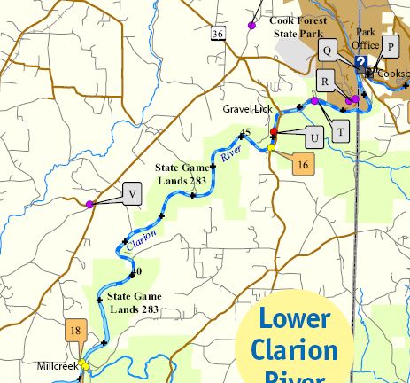
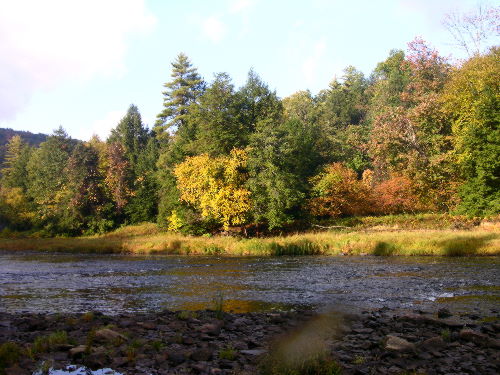
Carl Harting and I (Ed Frank) took a canoe trip on the Clarion River
on Thursday October 9, 2008. We traveled a section of the river
below Cook Forest from Gravel Lick Bridge to the Mill Creek access
in the backwaters of Piney Dam http://www.fish.state.pa.us/anglerboater/2005/04julaug/spec2clarion.pdf
. This is a distance of about 9 miles, the upper 6 miles of which
are part of the federally designated Wild & Scenic River system.
We met Dale Luthringer just before 8:00 am at Cook Forest. He would
not join us on the trip but loaned us one of the park canoes and
dropped us off at the start of the trip and pick us up again at the
end. Carl and I have done some volunteer work at Cook Forest such as
measuring trees, participating in deer density studies, and donating
a computer and program materials for use in the Log Cabin Inn nature
center, so this was a perk of the volunteer work we had done.
Dale dropped us off at the Gravel Lick Bridge about 3 miles
downstream from the route 36 bridge at the park. The river was low
this late in the season with a gauge reading of 1.93 at Cooksburg at
the start of our trip http://weather.hamweather.com/rivers/gauge/COKP1.html
This water level would have made a trip all the way from Cooksburg
to Mill Creek rather long given the number time we would need to
drag the canoe through the rocks in low water areas. Dale himself
had made this trip two days before with some of the Park Rangers so
he was able to give us a good idea of where we would need to wade
and push.
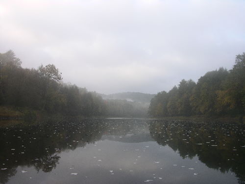 photo by Ed Frank
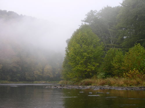 photo by Ed Frank
The morning started off well. We loaded the canoe and bid adieu to
Dale at the bridge. The morning was very foggy with rolls of
whiteness flowing down the river. We had barely pushed off and
headed downstream when a large mature bald eagle swooped across the
river a short distance away. My cameras were still in their bags, so
I didn't get any photos. Carl pointed for Dale to see, but the
gesture was lost in the mist. The river had a slow flow through this
area. As we lightly paddled down the river, the river before us was
revealed in the fog as the river behind us faded away.
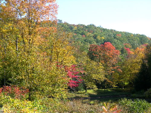
Along the Clarion River - photo by Ed Frank
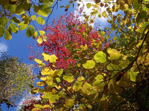
Witch Hazel and Maples, Blyson Run - photo by Carl Harting
The area we were paddling for the first six miles is almost entirely
surrounded by state game lands and has not been developed. We could
listen to the rustle of the waters across rocks and shore and look
across the landscape with nary a sign of man. After a short time the
fog began to burn off. We could see the hillsides ahead lit by the
morning sun and tinted gold by autumn leaves. Eventually the sun
drove the fog away and the sun filled the bright blue sky and we
continued our journey. The Clarion River for much of this stretch
flows down a steep sided valley with the banks typically rising
abruptly from the river's edge on one side or the other if not both.
We had to get out and pull the canoe through some stretches of the
river where the water was shallow, but this portion of the trip
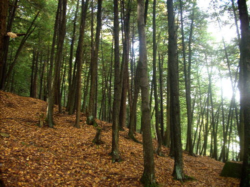
passed quickly. The forests along this stretch of the river are
young compared to those in Cook Forest and not particularly tall.
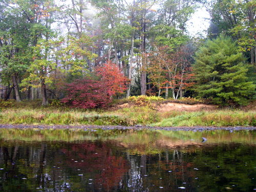
This was the upswing of the autumn colors for the region with yellow
dominating among the changing foliage.

Carl at Maxwell Run - photo by Ed Frank

Maxwell Run - photo by Ed Frank
The first stop we made was at the inflow of Maxwell Run, a small
stream flowing into the Clarion from the southeast. Dale had wanted
us to stop and check out some white pines in the area. He thought
some of them he saw a few days before may have reach 130 feet. The
entrance to the stream itself is behind a small barrier bar. A fat
white pine sits on a ledge above the outflow of the stream. The
stream itself flows down a series of flat rock ledges framed by
hemlock - very picturesque. Unfortunately the pines Dale saw were
not that high. It is difficult to judge the height of trees on a
steep slope, especially when they may be leaning slightly. Carl
measured three or four pines in the 1-teens, a cucumber tree to just
under 100 ft. I measured an eastern hemlock to 116, and a chestnut
oak to 94, but none of the trees approached 130. With more extensive
measurement perhaps we could find a 120, but we tried to measure the
biggest trees there.
Thin trees above Maxwell Run - photo by Ed Frank
Along the Clarion River - photo by Ed Frank
We continued downstream paddling and occasionally dragging the canoe
through the shallows. The next stop was what Carl referred to as the
State Road Ripple, a shallow spot used in the past as a portage. I
spotted a larger tree on the north side of the river with an unusual
form. It was multitrunk specimen that sprawled outward like a bush.
It had a similar shape to old apple trees or some of the big
hawthorns we had been finding elsewhere. We pulled over and hiked
through the sycamore sprouts, grass, and knotweed. Upon reaching the
tree we discovered it was a black gum. It certainly was the most
unusual shaped black gum I have seen. Unfortunately I did not
measure it. It wasn't that big, but still. In the same area we found
perhaps a quarter acre of Norway spruce, likely from an old
farmstead. Carl measured one of them to 104 feet. Also there were
several butternuts. The largest was 66 feet tall and 4' 2" in
girth. Another was fatter, but not as tall. None of the butternuts
were producing nuts.

Carl amongst the knotweed, Blyson Run - photo by Ed Frank
Ed at Blyson Run - photo by Carl Harting
The next stop was at the inflow of Blyson Run. The entrance area was
another sandbar covered with Japanese knotweed. The stream itself
behind the bar was another nice small stream. The trees in this area
were generally small. The only one of interest was a witch hazel,
perhaps 25 feet high and 5 inches in diameter. Shortly after
leaving the Blyson Run area we came to the backwaters of the Piney
Dam. This was flat water with no current, so we paddled the rest of
the journey. The water was infilling a steep sided valley. The banks
rose steeply along each side of the reservoir. We hugged the right
bank/north shore following the shade. Both of us had gotten some sun
during the day's trip. I was slightly red by the end of the day, but
not burned too much. Carl, with his red hair and lighter complexion
seemed to have gotten it worse than I.

Carl and the triple red oak - photo by Ed Frank
Along the north side of the river was an open area under the trees
used for camping, perhaps a patch of private property among the
gamelands. Of note was a red oak tree with a triple trunk. Each
trunk was perhaps 8 feet in diameter with a multitrunk diameter of
around 16 feet. Carl posed for a photo in front of it. A small
stream flowing into the river here was only a trickle. Before I
expected it we arrived at the Mill Creek access.
Upstream at Mill Creek - photo by Ed Frank

Wooden cribbing in old dam near mouth of Mill Creek - photo by
Ed Frank
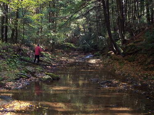
Carl and I decided to paddle a short distance up Mill Creek. Along
the 15 foot cliff to the right were a several trees of an unusual
shape. They had bent downward before again growing upward forming a
U shape at the bottom of the trunk. The bottom of the U in the trunk
was lower than the root level. One hemlock with this U shape was
approximately 1 foot in diameter. Several birches also displayed the
same U-shaped trunk. We paddled under a roadway bridge into Mill
Creek proper. This was a the site at one time of a sawmill operated
by the Cook family. Remains of wooden cribbing could be seen in what
once was the breastwork of the mill pond. We could not go much
farther upstream and turned back to the boat launch and pulled out.

U-shaped hemlock trun, Mill Creek - photo by Carl Harting

Scene at Mill Creek pull-out - photo by Ed Frank
Dale arrived shortly to gather us up, and we headed back to Cook
Forest. A nice day on the river.
Ed Frank and Carl Harting
Join me in the Eastern Native Tree Society at http://www.nativetreesociety.org
and in the Primal Forests - Ancient Trees Community at: http://primalforests.ning.com/
|