|
Hi Everyone,
Well, it is time for some images closer to home.
The 6 attached images were taken on the hike Monica and I did on
Sunday. The hike officially ended our vacation. The location of the
images is the Catskill Park in New York. Our specific destination
was the summit of Plateau Mountain. The hike up is very steep. We
gained about 1,500 feet in altitude, if not a little more, in a
distance of 1.4 miles. No matter how you cut it, that is steep, but
other Catskill trails can be even steeper. Unlike most of the
Berkshires, the eastern Catskills ARE mountains.
Atop Plateau, we walked in a miniature old growth forest of yellow
birch, red spruce, black cherry, mountain ash, balsam fir, and red
maple. I could just about reach to the tops of the trees. There is a
long stretch of top of the mountain old growth on Plateau. The whole
mountain complex includes a corridor of about 12 miles of old growth
with only a few breaks. Altogether, the Catskills have 64,000 acres
of OG, most of which would be unrecognizable except to the
well-trained eye. A few spots remain with large trees. I've not seen
them all.
By western standards, the Catskills are tame, but because the
starting elevations are low, one can gain 2,000 feet on many hikes
in Rip Van Winkles mountains and there are several treks in which
the elevation gain approaches 3,000 feet. The highest peak in the
Catskills is Slide Mountain at 4,180 feet. Hunter Mountain is second
at 4,025 feet. These two are the only 4,000-footers in the
Catskills. There are 35 peaks over 3,500 feet in the Catskills.
There is a 3500 Club that one joins by climbing all 35 of the peaks
under strict rules as what constitutes a separate climb.
I know of many OG sites in the Catskills, a few with
large trees. But Plateau Mountain is one of the Catskill OG sites
with stunted trees. Nonetheless, it is a place of great power and
high diversity. I identified 19 species of trees growing on Plateau.
I expect the full total is 3 or 4 more. Part of the mountain was
burned years ago, but is finally recovering with a dense forest.
Total annual precipitation is about 55 inches if not 60 on Plateau,
so the woods are dense.
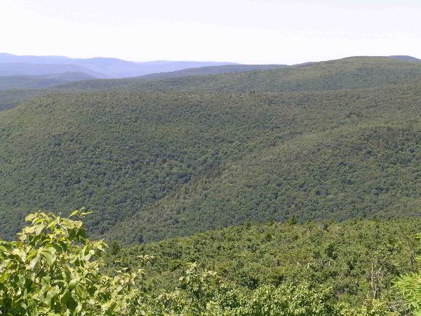
The first 3 images show the Catskill vastness. Image #1
looks south toward the Burroughs Range, named for the great 19th
century conservationist John Burroughs (1837-1921. It would be hard
to sing his praises too highly. He was a literary naturalist on a
par with Thoreau. The second image gives a more expansive view of
the Burroughs Range. Image #3 looks across toward the slope of
Hunter Mountain.
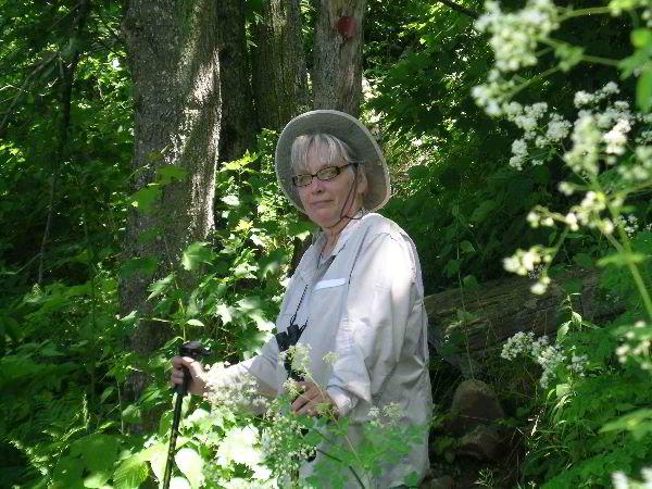
The last 3 images form the Sweetie Pie series, images
of Monica and the Catskills. The red spruce in image 2 of the Monica
series is approximately 200 years old based on a ring count of a
similar-sized spruce close by that had been cut after it fell over
the trail. The last image is of Sweetie Pie on the summit of
Plateau. The climb up was remarkably easy for us. We still enjoy the
high red blood cell count from our Durango, Colorado experience. It
does make a difference.
Bob
Barry Caselli (July 14, 2009)
writes:
Another enjoyable report with great pictures. I visited the
Catskills twice. Both times were on weekend retreats with people
from the church I was attending at the time. I believe this was
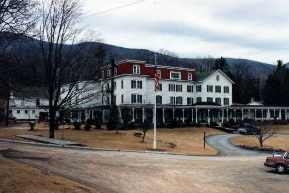
during the late 1980s. We stayed at an inn called Winter Clove Inn.
It was near a town or village called Round Top, NY, named for a
mountain called Round Top.
During one of the times I was there I decided to hike the trail up
the mountain behind the Inn. I have no idea if that mountain was
Round Top itself. Somewhere I have the photos I took while hiking
up. No one was interested in hiking, so I hiked by myself. I kept
going, and going. When I finally reached the very end of the trail I
decided to just keep going, and get to the top of the mountain. On
the very top of the mountain there was a small plane that had
crashed there, and it was laying upside down. Sometime in the late
1990s I was able to look up the registration number on it and come
up with all the details of the flight and subsequent crash.
Anyway, somewhere I have photos of the mountains taken from part way
up and from on the top. I also have photos of some clubmosses on the
mountain, and of course the upside down plane.
The only scans I have right now are of the inn itself and of the
covered footbridge that I had to cross at the beginning of the
trail.
The first photo of the inn was taken sometime soon after we arrived.
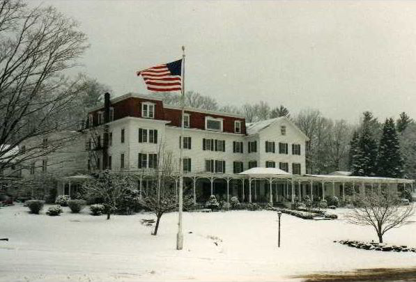
The second photo of the inn, the one with the snow, was taken the
morning we were due to leave. It was snowing when we got up that
morning.
I hope you like the photos. I didn't photograph any trees
specifically, but as I say, I did photograph the mountain scenery. I
just need to dig out all those photos and scan them.
Okay I just found the scans of the mountain photos and the plane,
but they are small and not that great. So I need to re-scan them.
Hope you enjoy the ones I've attached here.
Barry
--- On Tue, 7/14/09, dbhg...@comcast.net
<dbhg...@comcast.net>
wrote:
Continued
at:
http://groups.google.com/group/entstrees/browse_thread/thread/ab8e4ef46a910b6c?hl=en
http://groups.google.com/group/WNTS/browse_thread/thread/ab8e4ef46a910b6c
|