|
ENTS,
Yesterday Monica and I went to the Deerfield River Gorge on an
absolutely gorgeous day and climbed a favorite mountain of mine -
Negus Mountain in the central Berkshires. Negus lies on the east
side of popular Zoar Gap, destination of river rafters. At Negus's
foot lies the most challenging of the Deerfield River's white water
section. Across from Negus on the west side of the Deerfield River
is the province of Todd-Clark mountain massif, the easternmost
extension of Hoosac Mountain. Todd-Clark, as readers of my posts
know, lies in Mohawk Trail State Forest.
Negus is what I call the big little mountain. It isn't big in
mountain terms, but a climb to its pinnacled summit earns it respect
that does not happen from merely observing it from below. Negus
rises abruptly above the Deerfield River to help create the gorge
portion of what is more broadly known as the Deerfield River Valley.
At Zoar gap, the river's elevation is 630 feet and the summit of
Negus lies at 1,778 feet. This represents an altitude gain of 1,148
feet, and the gain occurs a little too quickly for those just out
for a leisurely hike in the Berkshires.
If one climbs both summits of Negus, the total elevation gain is
around 1,250 feet, but it is the half-mile gorge portion of the
first 0.6 miles of the climb that really gets the attention. The
route up Negus from Zoar Gap requires the use of the hands to mount
several ledge areas, which can be somewhat dangerous in wet
conditions. Negus stretches the idea of hiking to the limits.
One does not go to Negus to see large trees. The mountain has been
burned repeatedly, although there is an 50-acre old-growth oak
forest on Negus's southeastern-facing side.
The old Boston and Maine railroad, now Guilford, runs along Negus's
western side. Over the years, periodic fires from sparks emitted by
passing trains have insured that the slopes of Negus are always in a
fire recovery stage. However, for those of us as addicted to great
scenic spectacles as big trees, the fires have provided us with
perches from which we can enjoy unimpeded views of the gorge and
surrounding mountainous terrain. Without further comment, I present
seven images from Negus.
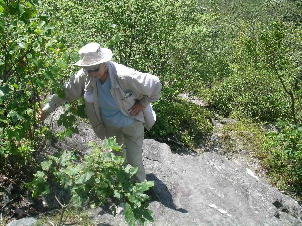
Image#1: The narrow, steep trail up Negus offers one the
opportunity to climb up rock ledges. Monica and I had just finished
the ledge in the image. I wanted to photographically document what
Monica had done since heights, even modest ones, tend to have an
unnerving effect on her. But yesterday, she was a trooper all the
way.
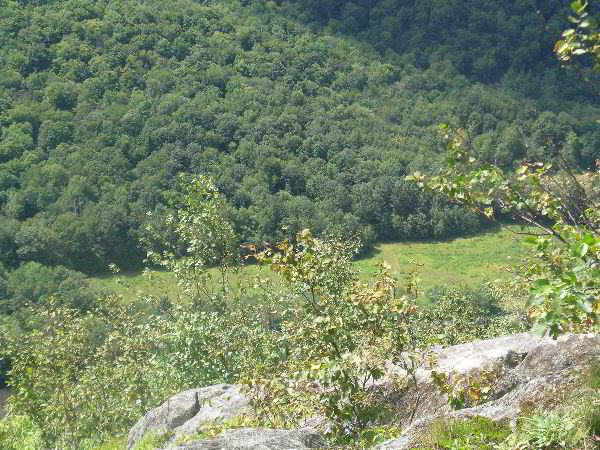
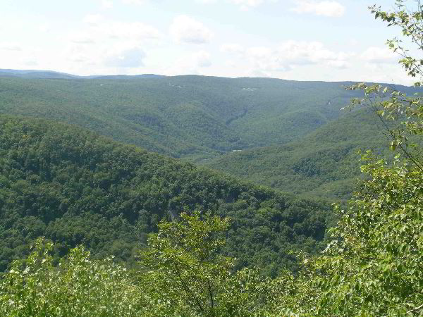
Image#2: From higher on the side of Negus, one begins to
appreciate the elevation that is being rapidly gained. This image
looks off one of the rock perches to a small field below. The
Deerfield River is just visible in the lower left-hand corner of the
image.
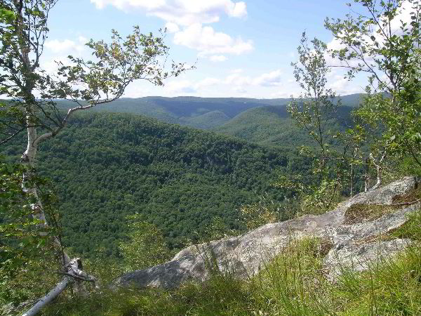
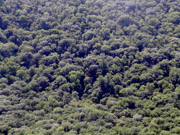
Image#3: From near Negus's sumit, the narrow green field is still
visible far below, but the view opens up into an exquisite panorama
that features the Hoosac Mountain ridge. Route #2 is near the top of
that ridge. A small white birch is in the foreground. It looks like
Betula cordifola to me. Any takes on that? There is papyrifera and
populifolia on the slopes for certain.
Image#4: This image was taken at the same location and picks up
some of the Negus bedrock. I think it is a complex schist. Joe
Zorzin would no for sure.
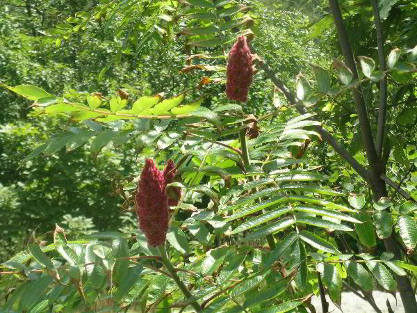
Image#5: On the summit ridge, northern red oak, shagbark hickory,
red maple, beech, white and gray birch, quaking and bigtooth aspen,
and in a few spots, sumac dominate. I couldn't resist taking an
image of the staghorn sumac. I used to use its berries to brew
Indian tea.
Image#6: In places profuse blooms of wildflowers almost took our
breath way. Negus is that kind of place.
Image#7: In the last image, the summit of Todd Mtn is seen to the
left. Moving to the right, we see the small sub-summit of Todd,
followed by the notch or gap between Todd and Clark. The ridge line
is building up toward the higher summit of Clark at the right side
of the image. In the distance, through the notch can be seen the
highest elevation of Mohawk Trail State Forest, a 2,080-rounded,
nameless summit. The Deerfield River is seen at the base of
Todd-Clark ridge. The forest shown on Todd-Clark is like few others
in the Northeast. Its Rucker Index stands at around 134 and includes
the great Saheda Pine with its crown now above 164 feet - one of our
three 50-meter pines.
If both sides of the mountain complex are included, the Rucker
index exceeds 135. I expect it is between 135.3 or 135.5. It is
important to note that the area of exceptionally high growth does
not include more than 350 acres. The Todd-Clark regions presents us
with the best of Massachusetts forests, but these special woodlands
are known to and appreciated by only a select few. It has been left
to the high priesthood of ENTS to explore, measure and record the
best these woodlands offer us. On an outing some years ago that I
led for the Forest Steward's Guild, ENTS member and forester Joe
Zorzin noted that the northern red oaks he saw were among the best
he had seen in Massachusetts.
Of special historical significance in the last image is the fact
that the old Mohawk Indian trail and its colonial aftermath runs
along the summit of Todd-Clark for a distance of 1.2 miles - still a
trail. This pathway is a historic, cultural, scenic, and ecological
treasure to the state. I have been very privileged to be able to
study and report to the citizens of Massachusetts what I've learned
about its existence and significance.
Thirty-three years ago when I was first getting acquainted with
the Berkshires, I climbed Negus and thought it to be exceptionally
scenic. One evening I was reading Harvey Broome's book "Out Under
the Sky of the Great Smokies." Broome was a past president of the
Wilderness Society and one given to rhetorical flourishes. About
2/3rds through the book, I came across a passage, which I
paraphrase. The context is Broome describing a hike in his beloved
Smokies and a view he had just come across: "and the view reminded
me of the view from the summit of Negus Mountain in Massachusetts."
Upon reading the passage, I let out a whoop and tossed the book up
into the air. Yes, someone of substance and experience had visited
Negus and had mightily approved.
Bob
Bob Leverett wrote (August 8, 2009)
Mike,
One end of the trail is located off Steele Brook Road. ATVers use
that end. The other is at Zoar Gap off River Road (Zoar Road). I
don't care for the Steele Brook Road end. I always go up from Zoar
Gap to get to the good views quickly. no monster trucks in that
area.
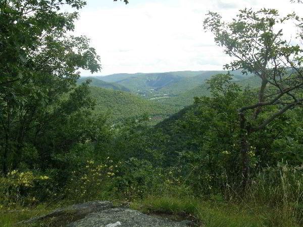
For your viewing pleasure, I have attached a 3 images. The first
is from near the summit of Negus looking toward the Hoosac Mountain
ridge, Route 2, and a few buildings in Florida, MA. The second image
was taken today and is of Trout Brook in MTSF. The last image was
taken in the Trout Brook watershed and features 5 white pines.
counting from the left, the first and third belong to the 150 Club.
The rightmost pine has heavy weevil damage and isn't particularly
attractive. Nonetheless, all are growing machines. The Route 2
corridor is visible as the area of light beyond the pines. The 3rd
pine from the left probably brushes 153 feet. I won't be able to
measure it accurately until the leaves drop. Its girth is now 8.6
feet.
Bob
----- Original Message -----
From: "Mike Leonard" <mlfores ...@rcn.com>
To: entstrees@googlegroups.com
Sent: Saturday, August 8, 2009 5:19:49 PM GMT -05:00 US/Canada
Eastern
Subject: [ENTS] Re: Negus, the big little mountain
Bob,
Where is the trailhead to Negus Mountain? Is it from Steele
Brook Road in Rowe or Zoar Road in Charlemont?
Sun and I have been section kayaking the fabulous and
pristine Deerfield River this summer. It is without question a
jewel of a river !
More on that later.
By the way next time you give a tour on the old growth at
Mohawk let me kno w ; Sun and I would like to go.
Mike
Here are some more images of Negus
Image #1: Looking back toward Berkshire East.
Image #2: Here is one that I bet you and some others will enjoy.
The view is over into Clark Ridge. The tall pine in the center of
the photo is the Joseph Brant Tree (Hgt = 160.2 ft, Girth=11.1 ft).
The group of 4 pines below the Joseph Brant Tree is the Oneida
cluster. The flagship of the cluster is the Oneida Pine. It was
155.1 feet tall and 10.0 feet in girth when I measured it last. I
expect it it is now between 155.7 and 155.9 feet. These are
magnificent trees.
Image#3: The rock I think you are referring to, but not a good
image of it. My challenge will be to capture it to your
satisfaction.
Image#4: A look at Mt. Greylock in the distance.
Image#5: Looking up the Deerfield River. You can see the railroad
on the right and the river in the center. Those features you'll
recognize. The hideous blight at the left edge of the image is a
quarry owned by a couple of insensitive fellows from Vermont. They
have done enormous damage to the viewscape from the summit of Negus.
Image#6: I'm sure you recall many scenes such as this. Photogenic
rocks on the spine of Negus.
Bob
Continued
at:
http://groups.google.com/group/entstrees/browse_thread/thread/c894798de0191c1a?hl=en
http://groups.google.com/group/entstrees/browse_thread/thread/0281517426d518f4?hl=en
|